Category Archives: Uncategorized

The Long Man of Wilmington +

It’s been nearly a month since my last blog, I’m afraid, due to lack of time.  This will therefore be a bumper entry featuring two sites and one exhibition in East Sussex, and a slight detour in between.

Beachy Head Woman

Beachy Head Woman

So today I started by heading over to Eastbourne to take in the Eastbourne Ancestors exhibition.  It’s housed in the Pavilion on the Royal Parade on the sea front and is easy to find.  There is plenty of parking in the car park for the Redoubt Fortress, which is next door.  It’s only a small exhibition and is very much aimed at the layperson.  However, what got it on my list of places to visit is that it is an osteoarchaeological exhibition, showcasing the results of a £73,800 Heritage Lottery funded project to analyse the sizeable collection of human skeletal remains recovered from archaeological excavations in the town over the years and held in store by Eastbourne Heritage Service.  More than 300 skeletons were analysed using modern techniques to identify the demographics and pathology of the skeletal remains.  In addition, in 11 selected cases radiocarbon dating and isotope analysis was carried out to identify when they died, what their diet consisted of and where they originated from.

The exhibition features skeletal remains, grave goods and reconstructions including one of so-called Beachy Head Woman, who lived around Eastbourne in the middle Roman period but whose ethnic origins were in sub-Saharan Africa.  She lived to be around 22-25, was 4ft 9in – 5ft 1in tall, had an ossified haematoma on her right femur, and ate a lot of fish and vegetables. Apparently further investigation is under way to find out more about her, as indeed are studies of the remainder of the collection within the constraints of the remaining funding.

Don't do it!

Don’t do it!

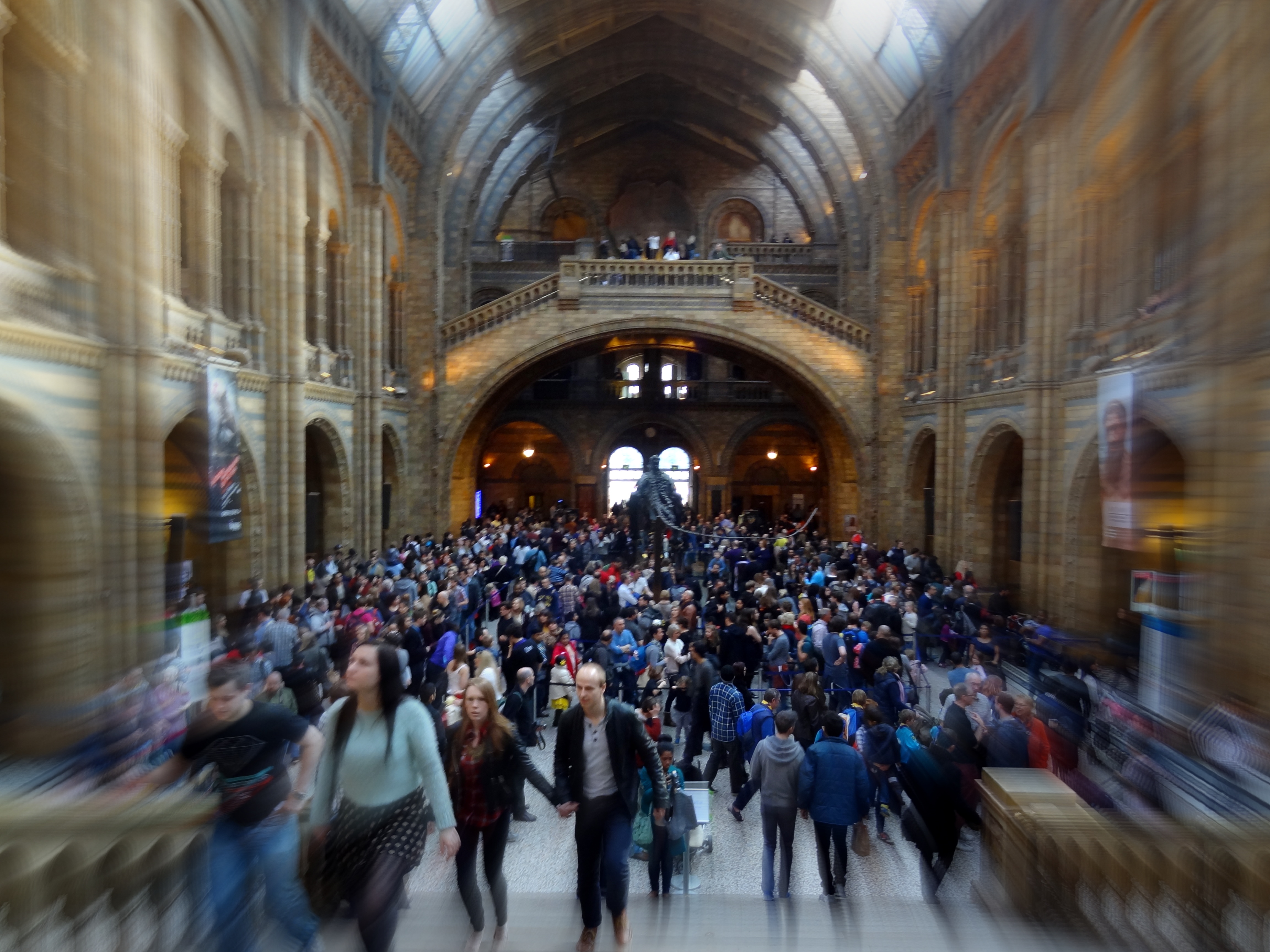
Following a cappuccino and a scone in the Pavilion cafe I followed the coast road with the thought in my mind that you can’t visit Eastbourne without paying Beachy Head a visit, neither of which I had been to before today. Despite a brief appearance by the sun when I entered the Pavilion a haar had descended by the time I re-emerged and there was a bit of a chill in the air.  However, undeterred, I parked up near the Belle Tout lighthouse (now a B&B with a fantastic view) and wandered along the coastal path taking care not to get too close to the edge, unlike the lady pictured.  I’m pleased to report that she didn’t fall over the edge and neither did the various other people with smartphones, tablets and cameras doing similar crazy things.  The Beachy Head chaplaincy vehicle in the layby and Samaritans sticker on the parking meter were however reminders of the darker side of things at the highest chalk sea cliff in Britain at a maximum of 162 m above sea level.

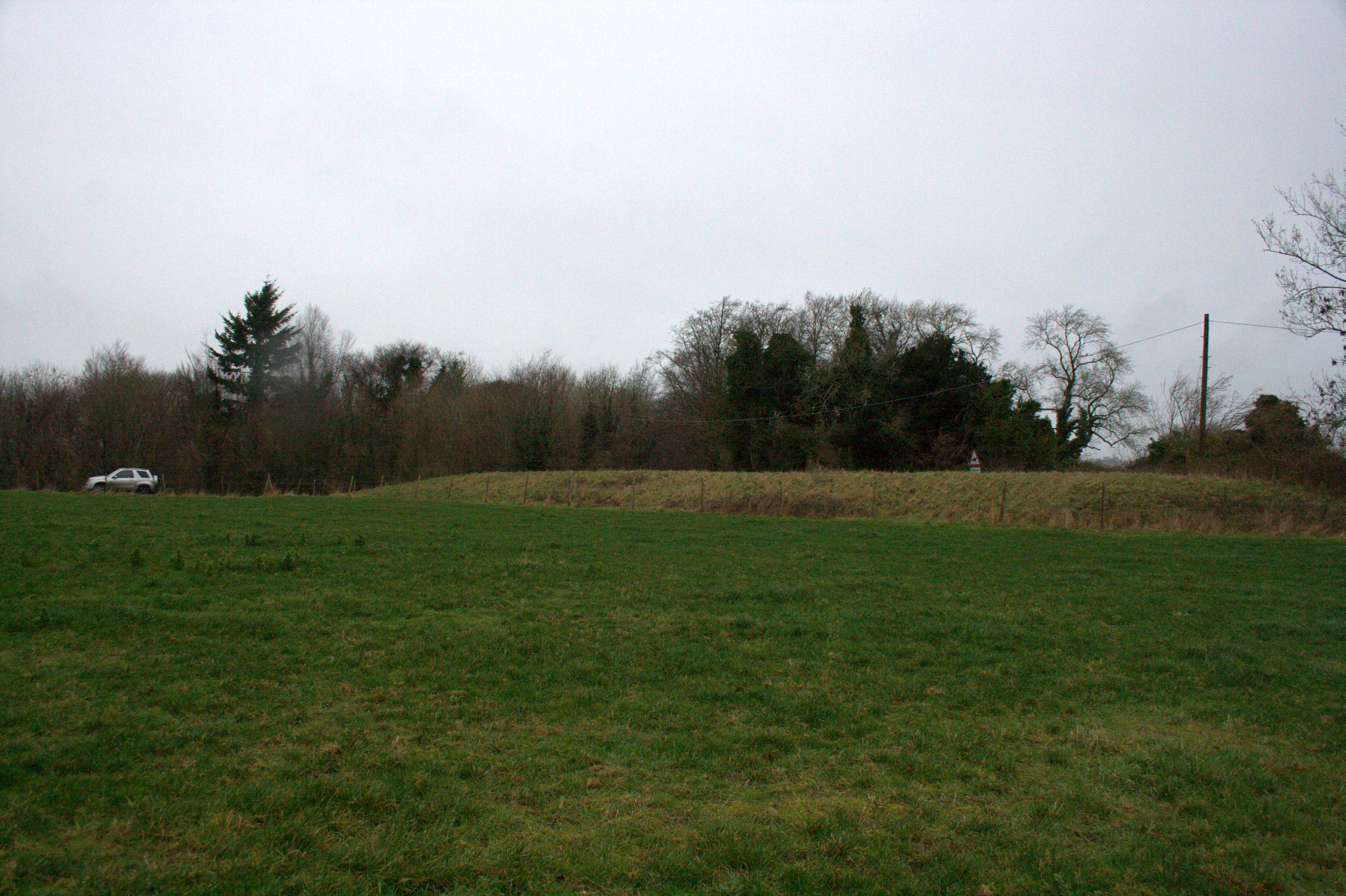
My next port of call was the Litlington Horse, that is the new one, which I passed quite by chance and noticed out of the corner of my eye.  There was previously a chalk horse on Hindover (aka High and Over) Hill (OS grid reference TQ 510 009) which was cut around 1838, perhaps to mark Queen Victoria’s coronation it has been suggested.  The present day horse is thought to have been cut as a replacement for the original in 1924/5 and is only around 100m from the first one’s position on the hill.  Its present day raised foreleg was apparently a 1983 modification.

Old Man of Wilmington

The Long Man of Wilmington

I then continued down the road to take in the Long Man of Wilmington on Windover Hill (OS grid reference TQ542034).  He’s quite a striking presence in the landscape and I wasn’t surprised to find that he is Europe’s largest representation of the human form.  Pleasingly his origins continue to baffle archaeologists and historians alike.  Theories include him being the creation of a Mediaeval monk from a nearby priory or that he was the work of the Romans, there being a Roman coin featuring a similar figure, or similarly the Anglo Saxons due to a likeness on some ornaments from that era. The purpose of the Long Man is also debated: could he be a depiction of a warrior or perhaps a fertility symbol?  Talking of which, the original artist missed out an important part of the male anatomy and so, it seems, modern day people sometimes feel the need to correct this with paint with varying levels of skill.  The current effort is pretty poor, I think.

The archaeology bit

The Long Man of Wilmington inhabits a significant known Neolithic landscape on the South Downs which includes the flint mines at Coombe Hill and the Giant’s Grave and Hunter’s Burgh long barrows and is is certainly possible that he was a part of things back then. There are also Bronze Age barrows in the vicinity and a Bronze Age axe hoard was found nearby so there is more than one prehistoric possibility for his origins.

The Long Man was excavated in 1969 and it was found that the original cut was deeper than it is now thereby making a bolder previous outline.  A resistivity survey at that time also revealed that the staves depicted as being held by the Long Man were probably longer than they are currently.  Fragments of red tile, previously found scattered within the outline, were analysed by Barry Cunliffe and found to be Roman indicating that the chalk figure at least dates back to the Romano British era although, of course, the Romans may merely have maintained or appropriated the Long Man for their own purposes and his creation may well have been prior to this.

Folklore

Parallels have been drawn with the Cerne Abbas Giant in Dorset and the presence of a Mediaeval monastic house near to both chalk giants has been used over the years to support an ecclesiastical connection.  Although the Roman tile fragments mentioned above clearly contradict this, talk of heretical monk occultists must have been a favourite explanation in the past.  It was also said that the giant represented Beowulf taking on Grendel.  He has been given numerous other identities over the years, all of heroic figures or deities, ranging from Thor to the Prophet Mohammed, as I suppose is only natural given his manly stature and pose.  My personal preference however is for him to be a Neolithic fertility symbol and that would seem to be as good an interpretation as any for the time being until such time as new archaeological evidence comes to light to disprove this or otherwise.

Refreshments

Just down the road from the man himself is the Giant’s Rest pub in Wilmington, a nice enough country pub (albeit very close to the A27) which has a good menu and, more importantly, is a stockist of ales from the nearby Long Man Brewery.  What other beer to have than the Long Man?

References

http://www.eastbournemuseums.co.uk/ancestors.aspx

http://www.giantsrest.co.uk/index.php

http://www.longmanbrewery.com/our-beers/

http://www.sussexarch.org.uk/saaf/wilmington.html

http://sussexpast.co.uk/properties-to-discover/the-long-man

http://www.wiltshirewhitehorses.org.uk/others.html


Leave a comment

Filed under Uncategorized

Britain: One Million Years of the Human Story

My favourite statistic is that more people visit museums than go to football matches on a Saturday in this country.  It therefore follows that only a fool would visit the Natural History Museum on this day of the week…DSC08671-001

So anyway, a little detour from my usual rambles today but one which still involved walking into the past and therefore probably just about counts.  The One Million Years exhibition is an accessible summary of the Ancient Human Occupation of Britain project and the current knowledge in this ever changing field.  The first thing you encounter is head casts of the four species of human in our history: Homo antecessor, Homo heidelbergensis, Homo neanderthalensis and Homo sapiens.  The exhibition certainly goes a long way to giving Homo neanderthalensis a better image.  For one thing, Ned the resident model Neanderthal is quite a good looking young man with a rather knowing look in his eye.  He is supposed to be in his 20s but looks older and wiser,  but then his life was probably arduous and his life expectancy was only 50 years.  The message comes across quite well, I think, that our probable closest relatives were intelligent, resourceful and successful, occupying Britain for at least 350,000 years (compared to Homo sapiens who have only managed about 40,000 so far).  I’m not sure if the Homo sapiens model has been given a name too but he is also rather ruggedly handsome and I liked his body painting.

Homo sapiens

Homo sapiens

There are some very fine flint and bone implements on display and the exhibition also covers climate and environment and the fauna that inhabited this land all those years ago.  In some ways it seems a shame we no longer have lions, wolves, mammoths and the like roaming around.  My favourite object on display was the skull cup from Gough’s Cave in Somerset.  Three of these were found in the cave, two made from adult skulls and one from a child’s. Although this is clear evidence of cannibalism, it is thought that the skill and effort involved in the fashioning of vessels from human bone was representative of more than a purely pragmatic act and may have been symbolic in some way.  Almost as interesting to me were the skeletal remains of a 33,000 year old Welshman recovered from Paviland (Goat) Cave in south Wales, which were found decorated with jewellery and dye, the earliest example of modern humans’ burial ritual in Britain.  Anyway, an enjoyable exhibition and I am now firmly of the opinion that I would like my DNA analysed to see if there’s any Neanderthal in me.  Bill Bailey, it turns out, is 1.5% Neanderthal so I’d be in good company.

Incidentally, the Wildlife Photographer of the Year exhibition was both inspiring and fascinating too.  There is much to learn from the write-ups on the methods as well as the camera settings used.  As was the case last time I went to this annual exhibition, the split of Canon/Nikon cameras used was probably about 50/50 (although I am happy to be corrected by anyone who has actually done the maths).

http://www.ahobproject.org/, accessed 08.03.14

http://www.nhm.ac.uk/visit-us/whats-on/temporary-exhibitions/britain-million-years/index.html, accessed 08.03.14

http://www.nhm.ac.uk/visit-us/wpy/visit/index.html, accessed 08.03.14

Leave a comment

Filed under Uncategorized

Cissbury Ring

Early Neolithic 4000 BC -> 3300 BC

Iron Age 800 BC -> 43 AD

Bottoms up

Having covered earthen long barrows and causewayed enclosures I thought it was time to pay a visit to the third major monument type of the early Neolithic: a flint mine.  Cissbury Ring is actually an Iron Age hillfort – the largest in Sussex – and occupies a fantastic location on the beautiful South Downs with extensive views across Sussex and Hampshire.  Within and without the hillfort are more than 200 flint mine shafts dating back to 5000 years ago, visible now as distinctive circular depressions in the ground.

Cissbury Ring Hillfort

Cissbury Ring Hillfort

It’s a straightforward site to find by following the road through Findon village off the A24, past the two pubs (slightly more of which later) and all the way to the end at which point  there is a car park, and then it’s a short (but steep) walk up to the hillfort.

The archaeology bit

There are fifteen known Neolithic flint mines in Britain, ten of them in the south, two in East Anglia, two in Scotland and one in Ireland.  Their locations, not always where the best quality flint seams are found, suggest that other factors were considered important by the Neolithic people who dug them laboriously with antler picks and other primitive tools.  Furthermore the recovery of human remains and other items apparently deposited deliberately in the mine shafts as well as carvings on the walls of the galleries, suggest that there was more than simply mining for resources involved and that the mines, in common with other aspects of the Neolithic world, were part of a wider and considerably more complex environment.

Cissbury flint mines

Cissbury flint mines

Cissbury was first excavated in the 19th century and then further investigations took place in the 1950s under the direction of John Pull, a Post Office employee and archaeology enthusiast.  He tended to publicised his findings in the local press due to his falling out with the local archaeological society when they rejected his written account of the Cissbury excavations and published one of their own.  He spent many years excavating Sussex flint mines and other sites but met a tragic and premature end when he was shot in a bank raid, leaving much unwritten investigation.

The flint mines at Cissbury are mainly situated at the western end of the later hillfort, with more outside the ramparts.  They are easily identifiable craters in the ground, measuring up to six metres in diameter with a depth of up to three metres.  Although human remains are unusual finds in Neolithic flint mines three skeletons were recovered during the Cissbury excavations: two females in the base layers of the mines with no obvious care afforded to them and a male in the upper fill in a crouched burial position.  The apparently different treatment of the sexes in life and death in terms of location and perhaps burial rites can be contemplated in this case.  With our modern day perspective, flint mines have often been regarded as male domains but an alternative view is that women would have been more suited to working in confined spaces due to their smaller stature.

Folklore

There is said to be a tunnel below Cissbury leading to nearby Offington Hall in which there is supposed to be treasure, unfortunately well guarded by serpents.  Cissbury itself is said to have been created by none other than the Devil while he was digging his Dyke near Brighton (actually the longest, deepest and widest dry valley in Britain), throwing earth around the general area.  And at the time of the midsummer solstice fairies are said to dance around Cissbury Ring.  A return in June to check this out could be on the cards on the basis that it must be a lovely place to watch the sun go down even if it turns out there aren’t any fairies and maybe a UFO will fly past, as others have claimed.

Refreshments

The two pubs in Findon, The Gun Inn and The Village House Inn, look very promising from the outside but on this occasion the refreshments were sampled in a hostelry nearer to home.

The Halfway Bridge, Lodsworth

The Halfway Bridge, Lodsworth, at dusk

The Halfway Bridge at Lodsworth is a pub I’ve driven past numerous times over the years but never stopped at before.  It’s a nicely updated, comfortable pub with unfailingly friendly staff and good beers including Doombar from the West Country and Langham’s from just down the road in West Sussex.  The classic and highly recommended Hip Hop was on offer but my personal favourite was Halfway to Heaven, 3.5% and goes down very nicely.  The food is good too and both the Caesar salad and fish and chips can be highly recommended.

References

Barber, M., Field, D. & Topping, P. The Neolithic Flint Mines of England 1999, Swindon, English Heritage

Lewis-Williams, D.P. & Pearce, D. Inside the Neolithic Mind 2005, London: Thames & Hudson

Russell, M. Rough Quarries, Rocks and Hills: John Pull and the Neolithic Flint Mines of Sussex 2001, Oxford: Oxbow

https://www.english-heritage.org.uk/discover/south-downs/explore/chanctonbury-cissbury/, accessed 07.03.14

http://www.sussexarch.org.uk/saaf/cissbury.html, accessed 07.03.14

Leave a comment

Filed under Uncategorized

Combe Gibbet

Early Neolithic 4000 BC -> 3300 BC

The clue’s in the name with this one.  Combe Gibbet is a Neolithic long barrow on Inkpen Hill (aka Inkpen Beacon, aka Gallows Down) around four miles south of Hungerford in Berkshire, not far from the borders of both Hampshire and Wiltshire. It is reached via a short, steep, somewhat bumpy track and you can park right by the access gate.

National Grid Reference: SU 36474 62235    Postcode: RG17 9EL


The archaeology bit

'Information board'

Once an information board

The barrow is around 65 m long and 20 m wide and its height ranges from 0.5 m and 1.5 m.  It is orientated east-west and has surviving full-length flanking ditches to the north and south with a depth of 0.5 m.  Of the 500 or so long barrows in England, Combe Gibbet is one of only three known in the county of Berkshire and geographically it is likely that these have connections to the more dense concentration of these monuments in Wiltshire and Dorset.  There is no record of the barrow having been excavated at any time and, unfortunately for my research, no record of any human remains having been found there, or any other finds for that matter with the exception of two probable Neolithic flint flakes from the surface handed in to Newbury Museum. The information board has seen better days and it would be nice to see this rectified.

The history bit

Long Barrow with added gibbet

Long Barrow with added gibbet

However what makes this long barrow fun is the presence of a gibbet on top of it. It is a double gibbet, that is one designed to hang two people simultaneously. I had never previously considered the possibility of a gibbet-for-two, not even when playing Hangman, but I can see now that this would have been useful in certain situations.  The Combe Gibbet gibbet stands 7.6 m tall, 25 m from the east end of the barrow.  The gibbet you see today is the seventh one to stand on the site, the original one having been placed there in 1676, more of which in a moment.  The subsequent gibbets were erected in the years 1850, 1949, 1950, 1970, 1979 and this one in 1992.  The original gibbet rotted and in turn the replacement met its demise at the hands of a lightening strike.  Two of the following gibbets were felled by vandals, reportedly in protest at the practice of hanging, one was blown down by high winds and another burned by vandals.  The Murder (Abolition of Death Penalty) Act of 1965 suspended capital punishment for murder in Britain and, of course, the punishment subsequently ceased permanently so the gibbet’s continued existence for the past 48 years has been symbolic, and rather strikingly so as it can be seen from quite some distance away.

Combe Gibbet

Combe Gibbet

The 17th century gibbet was erected to hang married George Bromham (possibly Broomham) from the village of Combe and widow Dorothy Newman from the nearby village of Inkpen who were found guilty of the murder of Bromham’s wife, Martha, and their son, Robert Bromham.  The trial at Winchester Assizes heard that George Bromham and Dorothy Newman beat Martha and Robert to death with staves very close to where the gibbet now stands, having been caught in the act of infidelity.  Apparently, the local ‘village idiot’, Mad Thomas, witnessed the event and reported the crime, leading to their conviction.  Based on these facts alone it can be wondered how safe the conviction was.  Anyway, the ‘hanging in [iron] chaynes’ took place on 3 March 1676 on the double gibbet erected on top of the barrow which was neutrally situated due to the parish boundaries of Combe and Inkpen stopping at the previously mentioned ditches, thereby enabling the cost of the gibbet and the ‘chaynes’ to be split equally, which seems only fair. The dead bodies were reportedly taken down the hill to Inkpen where they were kept in the barn at the Crown and Garter Inn before being returned to the gibbet for their ‘final hanging’ on 6 March.  I must say that the view from Combe Gibbet is wonderful and far reaching and today there were sheep grazing all around and several buzzards flying very low overhead.  I’m sure there are worse places to meet your maker.

Folklore

The method used by the convicted murderers to do away with poor Martha and Robert Bromham varies in different accounts. Some say they were killed by poisoning and/or drowning in a dew pond (incidentally, according to some accounts, Dorothy Newman’s own two children were murdered).  Alternatively, and rather horrifically, it has been said that Martha was killed by having her face thrust into a hornet’s nest by her husband.

Refreshments

Crown and Garter, Inkpen

Crown and Garter, Inkpen

Rather excitingly, the Crown and Garter Inn is still in Inkpen and still a pub and still has its barn in situ (now B&B accommodation called Gibbet Barn).  This would have been the perfect refreshment stop for today’s outing but, disappointingly, the pub is currently closed for refurbishment and not due to open again until August, according to a gentleman overheard talking about it in the The Swan Inn, a little further down the road.

The Swan Inn, Inkpen

The Swan Inn, Inkpen

Meanwhile The Swan is a nice, quiet pub and twice the West Berkshire CAMRA pub of the year.  It stocks Butt’s organic ales and the Jester was a pleasant, quaffable beer; the Traditional a little stronger. The barman was very friendly and helpful and the beef (from Inkpen itself) and onion pie is highly recommended.


References

http://www.hungerfordvirtualmuseum.co.uk/Places/Combe_Gibbet/combe_gibbet.html, accessed 27.02.14

http://list.english-heritage.org.uk/resultsingle_print.aspx?uid=1013198&showMap=1&showText=1, accessed 27.02.14

http://www.mysteriousbritain.co.uk/england/berkshire/ancient-sites/combe-gibbet-and-walbury-hillfort.html, accessed 27.02.14

http://www.pastscape.org.uk/hob.aspx?hob_id=228788&sort=4&search=all&criteria=combe%20gibbet&rational=q&recordsperpage=10, accessed 27.02.14

1 Comment

Filed under Uncategorized

Coming soon….

So much for doing a visit a week!  Ah well, that’s New Year’s resolutions for you. Sometimes life just gets a bit busy.  Anyway, I have some really good sites lined up for the next few weeks including a long barrow with a twist and some impressive holes in the ground, so watch this space…

Leave a comment

Filed under Uncategorized

Petersfield Heath

Early Bronze Age 2200 BC –> 1500 BC

I took a brief foray into the Bronze Age today, going for a wander around Petersfield Heath just down the road from me in Hampshire.  Like the Trundle, this is a place I’ve been visiting most of my life and while during my formative years I thought the Trundle was just a big hill, similarly I thought Petersfield Heath was merely a boating lake.  I now realise there is far more to it than that and it transpires that the 90 acres of the healthland there has a long and fascinating multi-age history dating back at least as far as the Bronze Age.

IMG_2795-003

Bronze Age barrow at Petersfield Heath

There are are a very impressive nineteen barrows at Petersfield Heath, one of the most complex groups of these burial mounds in southern England. They are situated to the north of the Heath Pond  and once you realise they are there you bump into them at almost every turn.  They are effectively in two main clusters, one of which begins just beyond the pond and the other which is a little further back surrounding the cricket ground.  A number of the barrows have conifers growing on top of them which were planted there in Victorian times.  The heathland was used for grazing stock from the Middle Ages until the 1920s.  It has also been used for peat digging, turf cutting, and various leisure pursuits.  The pond was created in the 18th century and in the late 19th century a golf course was constructed and remained there until 1998; it is now being returned to heathland.  All in all, the Heath has seen a lot of activity and use over the centuries and it is fortuitous that so many of the barrows have survived to the present day.

The OS coordinates are  SU 757 230 and parking is plentiful in the car park on the B2146.


The archaeology bit

The twenty one barrows (or tumuli) in evidence at Petersfield Heath comprise fifteen bowl barrows, three saucer barrows, two disc barrows and one bell barrow, the latter three types being much less commonly found than bowl barrows and along with pond barrows they are sometimes collectively known as ‘fancy’ or ‘Wessex’ barrows (I favour the former).  It’s fairly obvious that the given names for the different types of barrow are based on their physical appearance.  As an etymological aside, the word ‘tumulus’ derives from the Latin for mound or small hill, while ‘barrow’ can be traced back to the Old English (Anglo-Saxon) word beorg, which is related to berg, which in turn means ‘mountain’.  Alternative names in use in different parts of Britain are howe, lowe, cairn, tump, toot, cop and knap.

In Hampshire it is estimated that around three quarters of the original Bronze Age barrows have been lost over time to ploughing and other changes to the landscape so a large concentration like the one at Petersfield is an important link to the lives of our ancestors.  There would certainly have been more barrows here originally and in fact a 19th century Ordnance Survey map indicates that some have been lost as a result of the modern housing development to the north and east of the Heath.  Similarly, it is probable that more barrows were destroyed when the pond was created.  Multiple barrows like this are usually classed as a cemetery which refers to the traditional interpretation of these as burial mounds.  Human remains are indeed usually found within them although this is not always the case and there could be several reasons for their absence including their having been removed, perhaps during antiquarian investigations during the 18th and 19th centuries, the natural breakdown of remains over time, or never having been present in the first place.  The human remains can be both inhumations (in the ‘crouched’ position as is usual in Bronze Age contexts) and cremations, often in urns, and sometimes they are interred with grave goods such as pottery, weapons, tools and jewellery.  Overall it seems there is a variety of burial practices going on, between different mounds and within individual ones, indicating different approaches to the disposal of the dead, which can be speculated upon alongside the possible ceremonial practices that may have taken place before, during and after the construction of the barrows themselves in their particular locations.

Bronze Age barrow at Petersfield Heath

Bronze Age barrow at Petersfield Heath

Bronze Age barrows are often found near rivers, lakes and springs and regularly on middle and lower slopes rather than higher ground within the landscape.  It is interesting to consider the reasons for these choices of locations and both ritualistic and practical explanations have been suggested, such as people’s beliefs about the role of water within the Bronze Age world and drainage of the barrows themselves, perhaps allowing life to ‘seep away’ or literally to prevent damage to the mounds due to natural forces.  It is possible to see patterns in the distribution of surviving barrows in particular localities in relation to the landscape they inhabit and potentially with the route ways of Bronze Age people going about the business of their lives, indicating both pragmatic and belief-based concerns.  It has also been shown that some are aligned with celestial features and it seems that, although we separate prehistory into distinct eras for the sake of our modern day understanding, there are many themes and features that overlap throughout time.

IMG_2782-001

Bronze Age barrow at Petersfield Heath

The late eminent archaeologist, Stuart Piggott, who was born and educated in Petersfield, carried out the only survey to date of the barrows at the Heath back in 1930 when he was a student at Churcher’s College. However, Petersfield Museum has applied for funding from the Heritage Lottery Fund to conduct a four-year fieldwork and research project and hopefully this will be successful and enable a more detailed understanding of these prehistoric monuments.  I am planning to dust off my trowel and be involved in this myself along with another local project involving three Bronze Age barrows at Black Down in Haslemere, also planned for this year.

Edit (2018) The excavations have since taken place and you can read all about it here.

Folklore

I haven’t found any folklore pertaining to the Petersfield Heath barrows specifically but general folklore regarding barrows often involves people entering them, either invited or uninvited, and making off with valuable items from within them, subsequently suffering misfortune as a result.  In one version, a farmer drinks from a cup he is offered and disappears off with it, later returning to find that his wife is dead, his children elderly and nobody in the village remembers him, which has been interpreted to symbolise the passage of time and barrows separating the living from the dead. In general barrows are seen in folklore as magical places with links to faerie folk and providing an entrance to the realm of the goddess.  Whether you buy that or not there is, to me anyway, something very special about these ancient mounds and perhaps even more so in places like Petersfield Heath where they are surrounded by modernity and walked around (and on) every day by people going about their daily 21st century lives.

Refreshments

The Old Drum in Chapel Street, Petersfield, is a nicely modernised and dog-friendly establishment.  I would suggest a pint of 4.2% Triple FFF Moondance which I like not only for its pleasing colour and flavour but also because it has a wolf on its label and is the name of a rather good Van Morrison song.  It was also very popular back in my Haslemere Beer Festival days when I worked hard behind the bar in return for free beer throughout the evening (the only problem being there was no time to actually drink it).

References

Home

http://www.archaeologyuk.org/ba/ba43/ba43feat.html

http://www.english-heritage.org.uk/discover/south-downs/explore/petersfield-heath/

http://www3.hants.gov.uk/countryside/petersfield-heath.htm

http://www.pastscape.org.uk/hob.aspx?hob_id=243051#aRt

http://www.templeresearch.eclipse.co.uk/bronze/tomalin.htm

3 Comments

Filed under Uncategorized

The Trundle

Early Neolithic 4000 BC -> 3300 BC

Iron Age 800 BC -> 43 AD

Today I paid my local causewayed enclosure a visit, ably assisted by my father (whose fault it is that I became interested in archaeology in the first place).  The Trundle is situated on Goodwood Hill overlooking the racecourse with far reaching views towards Chichester and the Isle of Wight on a clear day.  It’s a lovely spot actually and I’ve been going there all my life: we used to go on family walks ‘up the Trundle’ when I was a child although in those days I thought it was just a big hill.

At the Trundle with my brother and grandpa c.1972

OS coordinates SU 81 SE 52.  The best place to park is in the car park at the end of the little track at the top of Goodwood Hill, just on the sharp bend to the left when approaching from Singleton.  I hadn’t noticed on previous visits but this part of the Goodwood Country Park, within the South Downs National Park, is called Seven Points. 

The archaeology bit

Prehistory-wise the Trundle is the site of both an Iron Age hillfort, also known as St Roche’s Hill, and the earlier Neolithic causewayed enclosure which it encircles and partly overlies. Although the Iron Age remains are quite obvious to anyone aware of their existence, due to the large surrounding bank and ditch, the Neolithic ones are far less discernible to the untrained eye and indeed probably best viewed from the air should you have access to a suitable form of transport (I don’t).  Also within the hillfort are the remains of a probable Medieval chapel, dedicated to St Roche.  I’ve tried to find out about said saint but can only find references to St Roch without an ‘e’.  If they are one and the same (and I’d be pleased if anyone could enlighten me as the Medieval era is not one I know much about) he was either the Patron Saint of the Plague or of the weather.  The chapel is unlikely to have been built before the last quarter of the 14th century and it was ruined by 1570, most likely as a result of the Dissolution.  A windmill was subsequently built on the site of the ruins but was razed in 1773.  There was also a masonic lodge on the hilltop in use from 1717 and 1757 and potentially a Bronze Age barrow beneath the site of these two buildings, so it is a site with an interesting, multi-period history.

Iron Age hillfort

Looking up to the Iron Age hillfort

Bank and ditch (and Dad)

Iron Age bank and ditch and Dad (slightly younger)

When I’d settled on the Neolithic as the era for my research I was looking forward to including the Trundle, so familiar and local to me, in my study.  My project centres around human remains in the early Neolithic era but, unfortunately, the Trundle will only get a small mention as the only human remains recovered during excavations there were fragmentary bone from some of the Iron Age pits, although they could have originated from the Neolithic phase of the site and been disturbed during later construction.

Causewayed enclosures are so-called because of their physical appearance of a series of concentric circles with internal ditches interrupted at intervals appearing to form causeways.  The Trundle is the largest example of a causewayed enclosure in southern England and comprises potentially five circuits.  There was been much debate over the years as to what the function of these monuments would have been with theories ranging from settlements or defensive structures to cattle enclosures or trade and exchange meeting places to ritual or burial places.  There seems enough variety of evidence to keep archaeologists debating the point of causewayed enclosures for the time being along with that of their early Neolithic contemporaries in southern England, the earthen long barrows and flint mines.  There are currently around 80 known causewayed enclosures in Britain, the vast majority of them in southern England with a few odd instances in Wales along with one in Cumbria and one in Northern Ireland.  Additionally there are a number of possible causewayed enclosure sites throughout southern England and a handful in Scotland.  These monuments are not confined to Britain though and are also found in France, Germany and Scandinavia; indeed it is thought that they probably originated in mainland Europe.

A recent, ground breaking radiocarbon dating study by Cardiff University and English Heritage has shown that causewayed enclosures began to appear in the landscape in the 38th century BC, increased significantly in number in the 37th century BC and that their construction began to cease by the end of the 36th century BC. Furthermore, a number of enclosures have been found to have very short lifespans.  All this evidence combines to characterise the early Neolithic as a time of rapid change and activity when these massive monuments were being constructed.  The fascination lies in why around 5800 years ago did people begin constructing them and what drove the early Neolithic people to put the undoubted effort necessary into doing so.

Folklore

Folklore regarding the Trundle involves the Devil and a golden calf.  It is said that a golden calf lies buried there but that any attempt to dig it up and benefit from its value is thwarted by the Devil himself (although he is not mentioned by name).

In the Down there’s a golden calf buried; people know very well where it is – I could show you any day.
Then why don’t you dig it up?
Oh, it’s not allowed; he wouldn’t let them.
Has anyone ever tried?
Oh yes, but it’s never there when you look; he moves it away.

There are accounts of the calf being known as Aaron’s Golden Calf, which may refer to the Catholic practice of burying valuable objects during the Reformation for safekeeping.  Alternatively, the legendary hoard may be a Viking one which a raiding party buried en route to a tussle at nearby Kingley Vale.  They are said to have left a ghost calf to guard the treasure and when the Vikings were defeated, not to return, the calf could be heard crying in the Goodwood woods.  It might be interesting to see if it is still crying…although I won’t be the one to conduct that particular bit of research.

Refreshments

IMG_2367-001The two nearby pubs are The Partridge in Singleton and our choice today: The Fox Goes Free at Charlton.  The Fox (as it used to be known, back in the days when the local hunt congregated there), is a cosy old pub with open fires, tiled floors, old school desks and chairs for seating, and heaps of character.  The beer’s good too: I would recommend the Fox Goes Free 3.8% from the Arundel Brewery.  Also available was the excellent Harvey’s Sussex Best and Otter Ale (from Devon).  The Fox is notable for being the venue of the first ever meeting of the Women’s Institute in December 1915.  Even more exciting than that, in 1975 an episode of Dr Who was filmed there: Terror of the Zygons, starring Tom Baker (the fourth and best Doctor) and Sarah Jane Smith.

References

Bayliss, A., Healy, F. & Whittle, A., 2011 Gathering Time: Dating the Early Neolithic Enclosures of Southern Britain and Ireland, Vol 1, Oxford, Oxbow

Parish, W.D. & Hall, H., 1957 A Dictionary of Sussex Dialect, Eastbourne, Gardners

Russell, M., 2001 The Early Neolithic Architecture of the South Downs, BAR British Series 321, Oxford, Archaeopress

Thomas, J. 1999 Understanding the Neolithic, London: Routledge

http://pastscape.org.uk/hob.aspx?hob_id+246354, accessed 22.01.14

http://cf.ac.uk/share/newsandevents/news/archaeology/neolithic-britain-revealed.html, accessed 22.01.14

http://www.english-heritage.org.uk/discover/south-downs/explore/trundle/, accessed 22.01.14

http://www.english-heritage.org.uk/publications/iha-causewayed-enclosures/causewayedenclosures.pdf, accessed 22.01.14

http://www.sussexarch.org.uk/saaf/trundle/html#folk, accessed 22.01.14


2 Comments

Filed under Uncategorized

Wayland’s Smithy

4000BC – 3200BC EARLY NEOLITHIC

Wayland’s Smithy is located on the The Ridgeway three quarters of a mile north-east of the B4000 Ashbury to Lambourn Road in Oxfordshire (although in some literature it is described as being in Berkshire which reflects a change of county boundaries at some point after the site was excavated).

The weather was every bit as good as the forecast had promised, pleasantly crisp with blue sky and sunshine all day long, ideal for a walk in the beautiful English landscape.  So I parked in the National Trust car park  at the top of White Horse Hill and, following my traditional fight with the parking ticket machine (it came off better, as is usual),wandered towards Dragon Hill, a striking flat-topped hill a little reminiscent of Silbury Hill though natural rather than man-made, via The Manger, a valley with eye-catching rippled sides known as the Giant’s Steps that are the product of retreating permafrost during the last Ice Age.

IMG_2218-001         IMG_2219-001

I had a little look at Uffington Castle, an Iron Age Hill fort with a nice bank and ditch surrounding it, and then headed off down The Ridgeway path in the direction of Wayland’s Smithy which is about a half hour walk from the car park.

+

The archaeology bit

I’d never been to this Neolithic chambered long barrow before but had been meaning to for ages.  It inhabits a very pleasant setting in a small copse on the edge of The Ridgeway path with far-reaching views beyond.  I tried to imagine how it would have looked within the landscape without the trees around it.  It would have been noticeable but not overbearingly so; the sort of place you would seek out in the knowledge of its existence or happen upon when in the area, perhaps.

Human remains of fourteen people have been found here and their burials dated to between 3590–3555 BC and the last in 3580–3550 BC, that is to a maximum period of fifteen years, which is less than a generation. They were actually buried in an earlier ovoid structure upon which the barrow seen today was subsequently built between 3460 and 3400 BC. It is trapezoid in form and much larger than its earlier counterpart.  Apart from anything else, the building of this later structure over the previous one makes Wayland’s Smithy intriguing.

IMG_2247-002

Of the fourteen human remains recovered from the earlier structure, eleven have been identified as male; all of them except one were adults. Demographically speaking, it has been suggested that gender was more important than age as a factor for burial rites at this time, in southern England although not necessarily in other regions.  The reason for the short period of usage is interesting to consider and a study has found that three of the individuals buried there may have been killed by arrow shot and it has been suggested that the burials may have been the consequence of a massacre. This would not be an isolated case of violence in the Neolithic; indeed conflict appears to have been part of life for people during that time, possibly coinciding with the advent of causewayed enclosures and their role in society.  But that’s another story for another day.  Another possible explanation for this potentially mass burial if the interment phase was at the shorter end of the scale is that of death due to disease.

IMG_2272-002

There are various other Neolithic burial mounds nearby, used up until Saxon times, and it can be wondered how these might have related to Wayland’s Smithy and how beliefs and rituals may have evolved and transcended the different eras over time.

As an aside, dog burials have often been found at Neolithic sites including Wayland’s Smithy, sometimes in association with human skulls. These have been interpreted as potentially demonstrating a significant relationship between dogs and people in life or death or perhaps transitionally between the two. Remains of piglets were also found amongst the rest of the animal bones at Wayland’s Smithy and the reasons behind the deposition of these and of animals generally, including baby animals, on Neolithic sites are very much open to interpretation. Reasons suggested include grave goods to accompany the dead on their journey to the afterlife, votive offerings to the gods, or simply the remains of feasting.

IMG_2261-002

For a brief few minutes today there was nobody else around and yet it had a friendly, comforting feel to it, I thought.  That may have been largely due to the sunny afternoon though; if the weather had been a bit more inclement there it might have taken on a moodier demeanour.  I’m not sure though: even with the light tree cover it still feels quite open and its position on the Ridgeway seems to make it part of things these days rather than something too isolated and foreboding.  There were also lots of people on the Ridgeway path going to and from the barrow: ramblers, dog walkers, cyclists; it felt a little like being on a pilgrimage.  I would like to visit in different conditions at different times of the year just to see how it feels and to try to understand how Neolithic people may have viewed Wayland’s Smithy within the landscape of their day-to-day lives.

Folklore

Originally known as ‘Weland’s Smithy’, Wayland’s Smithy is a product of the past mystical beliefs around metalworking and Wayland (aka Weland, Volund and Volundr) was either the Saxon god of metalworking or an invisible elfin smith, depending on your point of view.  According to local legend, if you leave your horse tethered there, along with a coin, then you will return to find that he has re-shod it in your absence.  If I had a horse I would have tried this out. Apparently a 13th century Norse poem, the Volundarkitha, tells the tale of Wayland but there are earlier mentions of aspects of the story in the poems Beowulf and Deor’s Lament.

Refreshments

On the way back to the car park I stood at the top of the Bronze Age Uffington White Horse but, of course, being so close it looked nothing like a horse.  After I left the car park in my car I tried briefly to find a viewpoint for the horse in its entirety but failed and so no picture of that, I’m afraid.  I also failed to find the White Horse pub at Woolstone, or rather, I was distracted by signs for the Fox and Hounds in Uffington itself.  It’s a cosy old pub although one with the television on (horse racing)  and music playing concurrently (Elton John).  The real ale selection was limited so I settled on Bob which is a very nice beer from the Wickwar brewery in Gloucestershire.  It’s also worth checking out the toilet seat in the Ladies’ loos.

References

Field, D. 2006 Earthen long barrows: the earliest monuments in the British Isles, Stroud: Tempus

Smith, M. & Brickley, M. 2009 People of the Long Barrows, Stroud: The History Press

Whittle, A., Healy, F. & Bayliss, A., Gathering Time: Dating the Early Neolithic Enclosures of Southern Britain and Ireland. Vol. 2. 2011, Oxford: Oxbow

http://www.berkshirehistory.com/legends/smithy02.html, accessed 11.01.14

http://english-heritage.org.uk/daysout/properties/waylands-smith/history-and-research, accessed 11.01.14

http://www.nationaltrust.org.uk/white-horse-hill, accessed 11.01.14


Leave a comment

Filed under Uncategorized

Bevis’s Thumb

4000BC – 3200BC EARLY NEOLITHIC

3200BC – 2300BC LATE NEOLITHIC

I wanted my first visit to be a Neolithic one, having confessed to it being my era of choice, and so it was that this afternoon I set off in rain and poor light to see my local earthen long barrow.  Long barrows, along with causewayed enclosures and flint mines, are the recognised monument types of the early Neolithic, each of which have been found to contain human remains, and together they provide a fascinating glimpse into the practices of Neolithic people and numerous possibilities for speculation as to the structures’ functions and place within the wider Neolithic landscape.  Bevis’s Thumb lies between Fernbeds Down and Telegraph Hill alongside the lane from Compton to the Mardens in the Chichester District of the South Downs and inhabits a peaceful location nestled in the corner of a field, skirted by a bramble hedge, beside a farm track.

The archaeology bit

I’d been there once before but still managed to miss it at the first attempt today. Once found though it’s hard to miss as it is one of the longest barrows in the south-east at 60 m with a width of 16 m at the western end although only 9 m at the eastern end which is truncated by the farm track, and 1.6-1.8 m high. 

Earthen long barrows are the earliest monuments in Britain, many dating back to the first quarter of the fourth millenium BC.  As is usually the case with the Neolithic (and the prehistoric period in general) there is little consensus on the role of these monuments and various theories exist.  Certainly some contain human interments and this led to their original interpretation as burial monuments potentially for elite members of society or perhaps victims of warfare.  It has been suggested that  they may have been markers in the landscape (Renfrew, 1973; Chapman, 1981).  There is much variety in the size and structure of long barrows and this makes generalisation difficult and provides archaeologists with an ongoing challenge in their attempts to decipher their function and meaning in the greater scheme of things.

There is a single radiocarbon date attributed to Bevis’s Thumb of 2500-2700 BC obtained from charcoal recovered from the bottom of the ditch during excavations in 1980 when a number of flint tools and animal bones were recovered.  There are oval barrows to the south-east of Bevis’s Thumb which are possibly associated with it and a similar carbon date from the one at nearby North Marden could be combined to perhaps suggest that the barrows here are pre-dated by the local causewayed enclosures, which would be the opposite case to other areas in England where they are found.  Long barrows and oval barrows are sometimes confused but they are two distinct categories within the suite of monuments for the Neolithic period as a whole.  Around 500 long barrows are known throughout England and further examples are found in Wales, Scotland and Ireland.  They are rectangular or trapezoid in shape and usually situated on raised areas in the landscape.  Oval barrows, on the other hand, which are generally dated later than long barrows, are elliptical in shape and are found in more low-lying locations.  They are far less common with only around 50 known examples which are found between Dorset and Norfolk with concentrations in East and West Sussex.  The Neolithic period has long been seen as a time of peaceful farming communities living alongside each other in the landscape however more recent research has revealed a more complex picture of mobile herders at times involved in warfare whose lives centred around grand ritual practices at these places where their ancestors were often buried.

One thing I have definitely concluded is that long barrows are not the easiest thing to photograph.  I wandered around the mound in the by now pouring rain, whacked up the ISO, and tried to find an angle to show the mound at its best.  I largely failed but the picture below at least shows its scale due to the presence of my car.  Below that is the view from the top which I just think is (slightly) more interesting and shows its proximity to the road by virtue of the sign to the right.

Folklore

IMG_2054.CR2-001IMG_2058The Bevis in Bevis’s Thumb was apparently a legendary local giant (aka Beavis or Baverse) who purportedly ate an ox washed down with two hogshead of beer every week. Given the size of his thumb that doesn’t seem enough for one so huge – perhaps that’s where the tale falls down.  The monument has also been known as Solomon’s Thumb which is thought to have been a Mediaeval Christianisation of its Pagan past.

As a site to visit it won’t take long but I think it’s well worth taking a little walk alongside this ancient earthen mound and to appreciate its size and the effort that must have been involved in building it some 4500 years ago with nothing but primitive tools and manpower and to consider why the people of Neolithic would have gone to such lengths.  Whose remains were interred there and why?  How did this monument relate to contemporary ones in the local area and the wider region and indeed the rest of the country?  What did the people of the time believe in?  Short of travelling back in time, we will of course never have the definitive answers to these questions but it can be fun trying to work them out.  And that, for me, is the joy of archaeology.

Refreshments

Pub-wise, the Coach and Horses in Compton serves Ballards and Langham ales, both excellent local micro-breweries. Alternatively, you could go in the direction of South Harting and visit the White Hart which serves Upham ales from Hampshire, the 3.6% Tipster being the most palatable in my view.

References

Chapman, R 1981 ‘The emergence of formal dispersal areas and the ‘problem’ of megalithic tombs‘. R. Chapman, I. Kines and K. Randborg (eds) The Archaeology of Death, 71-82 Cambridge: Cambridge University Press

Grinsell, L V 1936 The Ancient Burial-mounds of England. Methuen pp. 14, 80

Renfrew, C 1973 ‘Monuments, mobility and social organisation in Neolithic Wessex’ in C. Renfrew (ed) The explanation of culture change: models in prehistory, 539-588 London: Duckworth

Smith, M & Brickley, M 2009 People of the Long Barrows, Stroud: The History Press

SMR County monument no 0183 –  Re Bevis’s Thumb long barrow

http://www.eng-h.gov.uk/mpp/mcd, accessed 04.01.2014

http://sussexpast.co.uk/wp-content/uploads/2011/08/06-09FRCF-for-web.pdf, accessed 04.01.14

Leave a comment

Filed under Uncategorized

So much archaeology, so little time

One of my main resolutions for 2014 is to visit more archaeological sites, some that I’ve seen before and many that I’ve been meaning to get to but haven’t yet managed.  I have a ‘hit list’ of British sites and my plan is to try and see at least one every week of the year. In order to record the experiences and also to share the joy of our wonderful heritage I am going to use this blog to write about each visit, both in terms of the archaeology itself and as a visitor experience, and I’ll illustrate it with photographs I take, such as the one at the top of this page from the Ring of Brodgar in Orkney last August.  In addition, given that we are never far from a public house in this country, it seems appropriate to tie my trips in with the sampling of local hostelries, with particular emphasis on their real ales, and to include these in my reports.

An archaeologist by training, I have a love of all things old and particular fondness for mortuary practice and time-wise for prehistory, specifically the Neolithic, and it is likely that my posts will reflect these interests although not exclusively.

Anyway, my first visit is planned for this coming weekend so watch this space!

Leave a comment

Filed under Uncategorized